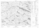
Maps showing Upper Creek First Pond, Newfoundland and Labrador
Upper Creek First Pond is a Lake located in Newfoundland and Labrador.
- Latitude: 52° 22' 6'' North (decimal: 52.3683498)
- Longitude: 56° 6' 10'' West (decimal: -56.1028998)
- Topography Feature Category: Lake
- Geographical Feature: Pond
- Canadian Province/Territory: Newfoundland and Labrador
- Atlas of Canada Locator Map: Upper Creek First Pond
- GPS Coordinate Locator Map: Upper Creek First Pond Lat/Long
Upper Creek First Pond NTS Map Sheets