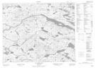
Maps showing Upper Creek Second Pond, Newfoundland and Labrador
Upper Creek Second Pond is a Lake located in Newfoundland and Labrador.
- Latitude: 52° 21' 34'' North (decimal: 52.3593800)
- Longitude: 56° 7' 24'' West (decimal: -56.1233700)
- Topography Feature Category: Lake
- Geographical Feature: Pond
- Canadian Province/Territory: Newfoundland and Labrador
- Atlas of Canada Locator Map: Upper Creek Second Pond
- GPS Coordinate Locator Map: Upper Creek Second Pond Lat/Long
Upper Creek Second Pond NTS Map Sheets