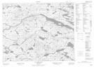
Maps showing Wallmans Hill, Newfoundland and Labrador
Wallmans Hill is a Mountain located in Newfoundland and Labrador.
- Latitude: 52° 26' 19'' North (decimal: 52.4385800)
- Longitude: 56° 7' 24'' West (decimal: -56.1234699)
- Topography Feature Category: Mountain
- Geographical Feature: Hill
- Canadian Province/Territory: Newfoundland and Labrador
- Atlas of Canada Locator Map: Wallmans Hill
- GPS Coordinate Locator Map: Wallmans Hill Lat/Long
Wallmans Hill NTS Map Sheets