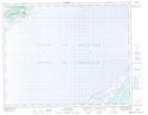
Maps showing Lead of Ponds, Newfoundland and Labrador
Lead of Ponds is a Lake located in Newfoundland and Labrador.
- Latitude: 51° 43' 47'' North (decimal: 51.7298599)
- Longitude: 56° 29' 38'' West (decimal: -56.4937600)
- Topography Feature Category: Lake
- Geographical Feature: Ponds
- Canadian Province/Territory: Newfoundland and Labrador
- Atlas of Canada Locator Map: Lead of Ponds
- GPS Coordinate Locator Map: Lead of Ponds Lat/Long
Lead of Ponds NTS Map Sheets