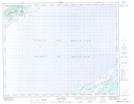
Maps showing Tracey Hill, Newfoundland and Labrador
Tracey Hill is a Mountain located in Newfoundland and Labrador.
- Latitude: 51° 43' 29'' North (decimal: 51.7248399)
- Longitude: 56° 28' 37'' West (decimal: -56.4770098)
- Topography Feature Category: Mountain
- Geographical Feature: Hill
- Canadian Province/Territory: Newfoundland and Labrador
- Atlas of Canada Locator Map: Tracey Hill
- GPS Coordinate Locator Map: Tracey Hill Lat/Long
Tracey Hill NTS Map Sheets