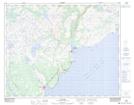
Maps showing L'Anse-au-Diable Pond, Newfoundland and Labrador
L'Anse-au-Diable Pond is a Lake located in Newfoundland and Labrador.
- Latitude: 51° 35' 52'' North (decimal: 51.5976498)
- Longitude: 56° 46' 38'' West (decimal: -56.7770998)
- Topography Feature Category: Lake
- Geographical Feature: Pond
- Canadian Province/Territory: Newfoundland and Labrador
- Atlas of Canada Locator Map: L'Anse-au-Diable Pond
- GPS Coordinate Locator Map: L'Anse-au-Diable Pond Lat/Long
L'Anse-au-Diable Pond NTS Map Sheets