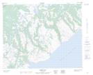
Maps showing Laydens Pond, Newfoundland and Labrador
Laydens Pond is a Lake located in Newfoundland and Labrador.
- Latitude: 51° 58' 10'' North (decimal: 51.9695799)
- Longitude: 56° 17' 11'' West (decimal: -56.2863598)
- Topography Feature Category: Lake
- Geographical Feature: Pond
- Canadian Province/Territory: Newfoundland and Labrador
- Atlas of Canada Locator Map: Laydens Pond
- GPS Coordinate Locator Map: Laydens Pond Lat/Long
Laydens Pond NTS Map Sheets