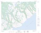
Maps showing Little Stag Pond, Newfoundland and Labrador
Little Stag Pond is a Lake located in Newfoundland and Labrador.
- Latitude: 51° 50' 29'' North (decimal: 51.8414900)
- Longitude: 56° 25' 33'' West (decimal: -56.4256998)
- Topography Feature Category: Lake
- Geographical Feature: Pond
- Canadian Province/Territory: Newfoundland and Labrador
- Atlas of Canada Locator Map: Little Stag Pond
- GPS Coordinate Locator Map: Little Stag Pond Lat/Long
Little Stag Pond NTS Map Sheets