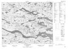
Maps showing Blow Me Down Hill, Newfoundland and Labrador
Blow Me Down Hill is a Mountain located in Newfoundland and Labrador.
- Latitude: 52° 33' 40'' North (decimal: 52.5611099)
- Longitude: 56° 19' 57'' West (decimal: -56.3324699)
- Topography Feature Category: Mountain
- Geographical Feature: Hill
- Canadian Province/Territory: Newfoundland and Labrador
- Atlas of Canada Locator Map: Blow Me Down Hill
- GPS Coordinate Locator Map: Blow Me Down Hill Lat/Long
Blow Me Down Hill NTS Map Sheets