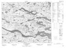
Maps showing Trout Pond, Newfoundland and Labrador
Trout Pond is a Lake located in Newfoundland and Labrador.
- Latitude: 52° 39' 13'' North (decimal: 52.6537499)
- Longitude: 56° 27' 44'' West (decimal: -56.4622799)
- Topography Feature Category: Lake
- Geographical Feature: Pond
- Canadian Province/Territory: Newfoundland and Labrador
- Atlas of Canada Locator Map: Trout Pond
- GPS Coordinate Locator Map: Trout Pond Lat/Long
Trout Pond NTS Map Sheets