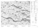
Maps showing Reeves Brook, Newfoundland and Labrador
Reeves Brook is a River located in Newfoundland and Labrador.
- Latitude: 52° 35' 53'' North (decimal: 52.5980700)
- Longitude: 56° 29' 45'' West (decimal: -56.4959700)
- Topography Feature Category: River
- Geographical Feature: Brook
- Canadian Province/Territory: Newfoundland and Labrador
- Atlas of Canada Locator Map: Reeves Brook
- GPS Coordinate Locator Map: Reeves Brook Lat/Long
Reeves Brook NTS Map Sheets