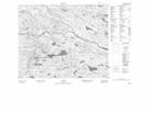
Maps showing Burnwood Brook, Newfoundland and Labrador
Burnwood Brook is a River located in Newfoundland and Labrador.
- Latitude: 52° 39' 1'' North (decimal: 52.6501699)
- Longitude: 56° 41' 16'' West (decimal: -56.6878600)
- Topography Feature Category: River
- Geographical Feature: Brook
- Canadian Province/Territory: Newfoundland and Labrador
- Atlas of Canada Locator Map: Burnwood Brook
- GPS Coordinate Locator Map: Burnwood Brook Lat/Long
Burnwood Brook NTS Map Sheets