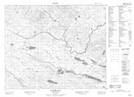
Maps showing Jeffries Marshes, Newfoundland and Labrador
Jeffries Marshes is a Low vegetation located in Newfoundland and Labrador.
- Latitude: 52° 47' 58'' North (decimal: 52.7994398)
- Longitude: 56° 43' 2'' West (decimal: -56.7172300)
- Topography Feature Category: Low vegetation
- Geographical Feature: Marshes
- Canadian Province/Territory: Newfoundland and Labrador
- Atlas of Canada Locator Map: Jeffries Marshes
- GPS Coordinate Locator Map: Jeffries Marshes Lat/Long
Jeffries Marshes NTS Map Sheets