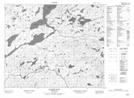
Maps showing Raspberry Point, Newfoundland and Labrador
Raspberry Point is a Cape located in Newfoundland and Labrador.
- Latitude: 53° 26' 1'' North (decimal: 53.4336099)
- Longitude: 57° 17' 2'' West (decimal: -57.2839398)
- Topography Feature Category: Cape
- Geographical Feature: Point
- Canadian Province/Territory: Newfoundland and Labrador
- Atlas of Canada Locator Map: Raspberry Point
- GPS Coordinate Locator Map: Raspberry Point Lat/Long
Raspberry Point NTS Map Sheets