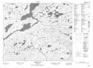
Maps showing Rat Pond, Newfoundland and Labrador
Rat Pond is a Lake located in Newfoundland and Labrador.
- Latitude: 53° 28' 52'' North (decimal: 53.4811798)
- Longitude: 57° 6' 34'' West (decimal: -57.1094698)
- Topography Feature Category: Lake
- Geographical Feature: Pond
- Canadian Province/Territory: Newfoundland and Labrador
- Atlas of Canada Locator Map: Rat Pond
- GPS Coordinate Locator Map: Rat Pond Lat/Long
Rat Pond NTS Map Sheets