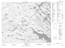
Maps showing St. Michaels White Hills, Newfoundland and Labrador
St. Michaels White Hills is a Mountain located in Newfoundland and Labrador.
- Latitude: 52° 51' 59'' North (decimal: 52.8665098)
- Longitude: 56° 24' 36'' West (decimal: -56.4099600)
- Topography Feature Category: Mountain
- Geographical Feature: Hills
- Canadian Province/Territory: Newfoundland and Labrador
- Atlas of Canada Locator Map: St. Michaels White Hills
- GPS Coordinate Locator Map: St. Michaels White Hills Lat/Long
St. Michaels White Hills NTS Map Sheets