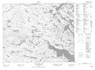
Maps showing Little Feeder Pond, Newfoundland and Labrador
Little Feeder Pond is a Lake located in Newfoundland and Labrador.
- Latitude: 52° 54' 13'' North (decimal: 52.9036898)
- Longitude: 56° 27' 23'' West (decimal: -56.4565198)
- Topography Feature Category: Lake
- Geographical Feature: Pond
- Canadian Province/Territory: Newfoundland and Labrador
- Atlas of Canada Locator Map: Little Feeder Pond
- GPS Coordinate Locator Map: Little Feeder Pond Lat/Long
Little Feeder Pond NTS Map Sheets