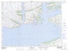
Maps showing Matt Lees Way, Newfoundland and Labrador
Matt Lees Way is a Road feature located in Newfoundland and Labrador.
- Latitude: 47° 37' 24'' North (decimal: 47.6233999)
- Longitude: 55° 59' 58'' West (decimal: -55.9995398)
- Topography Feature Category: Road feature
- Geographical Feature: Path
- Canadian Province/Territory: Newfoundland and Labrador
- Atlas of Canada Locator Map: Matt Lees Way
- GPS Coordinate Locator Map: Matt Lees Way Lat/Long