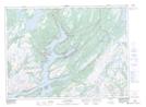
Maps showing Witch Hazel Hill, Newfoundland and Labrador
Witch Hazel Hill is a Mountain located in Newfoundland and Labrador.
- Latitude: 47° 58' 16'' North (decimal: 47.9712298)
- Longitude: 55° 58' 4'' West (decimal: -55.9678400)
- Topography Feature Category: Mountain
- Geographical Feature: Hill
- Canadian Province/Territory: Newfoundland and Labrador
- Atlas of Canada Locator Map: Witch Hazel Hill
- GPS Coordinate Locator Map: Witch Hazel Hill Lat/Long
Witch Hazel Hill NTS Map Sheets