Maps showing Steady Path, Newfoundland and Labrador
Steady Path is a Road feature located in Newfoundland and Labrador.
- Latitude: 47° 56' 45'' North (decimal: 47.9459498)
- Longitude: 55° 39' 48'' West (decimal: -55.6633398)
- Topography Feature Category: Road feature
- Geographical Feature: Path
- Canadian Province/Territory: Newfoundland and Labrador
- Atlas of Canada Locator Map: Steady Path
- GPS Coordinate Locator Map: Steady Path Lat/Long
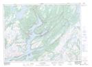
Steady Path NTS Map Sheets