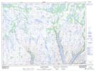
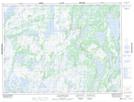
Maps showing Seven Island Pond, Newfoundland and Labrador
Seven Island Pond is a Lake located in Newfoundland and Labrador.
- Latitude: 48° 0' 34'' North (decimal: 48.0095013)
- Longitude: 56° 1' 19'' West (decimal: -56.0220699)
- Topography Feature Category: Lake
- Geographical Feature: Pond
- Canadian Province/Territory: Newfoundland and Labrador
- Atlas of Canada Locator Map: Seven Island Pond
- GPS Coordinate Locator Map: Seven Island Pond Lat/Long
Seven Island Pond NTS Map Sheets