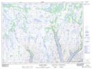
Maps showing Lazarus Point, Newfoundland and Labrador
Lazarus Point is a Cape located in Newfoundland and Labrador.
- Latitude: 47° 47' 35'' North (decimal: 47.7929499)
- Longitude: 56° 1' 54'' West (decimal: -56.0316998)
- Topography Feature Category: Cape
- Geographical Feature: Point
- Canadian Province/Territory: Newfoundland and Labrador
- Atlas of Canada Locator Map: Lazarus Point
- GPS Coordinate Locator Map: Lazarus Point Lat/Long
Lazarus Point NTS Map Sheets