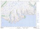
Maps showing Man Pond, Newfoundland and Labrador
Man Pond is a Lake located in Newfoundland and Labrador.
- Latitude: 47° 41' 20'' North (decimal: 47.6889199)
- Longitude: 56° 50' 6'' West (decimal: -56.8349500)
- Topography Feature Category: Lake
- Geographical Feature: Pond
- Canadian Province/Territory: Newfoundland and Labrador
- Atlas of Canada Locator Map: Man Pond
- GPS Coordinate Locator Map: Man Pond Lat/Long
Man Pond NTS Map Sheets