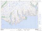
Maps showing Peters Hill, Newfoundland and Labrador
Peters Hill is a Mountain located in Newfoundland and Labrador.
- Latitude: 47° 35' 41'' North (decimal: 47.5947696)
- Longitude: 56° 48' 6'' West (decimal: -56.8017196)
- Topography Feature Category: Mountain
- Geographical Feature: Hill
- Canadian Province/Territory: Newfoundland and Labrador
- Atlas of Canada Locator Map: Peters Hill
- GPS Coordinate Locator Map: Peters Hill Lat/Long
Peters Hill NTS Map Sheets