Maps showing Bill Whites Pond, Newfoundland and Labrador
Bill Whites Pond is a Lake located in Newfoundland and Labrador.
- Latitude: 47° 38' 31'' North (decimal: 47.6419100)
- Longitude: 56° 48' 38'' West (decimal: -56.8105398)
- Topography Feature Category: Lake
- Geographical Feature: Pond
- Canadian Province/Territory: Newfoundland and Labrador
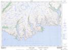
- Atlas of Canada Locator Map: Bill Whites Pond
- GPS Coordinate Locator Map: Bill Whites Pond Lat/Long
Bill Whites Pond NTS Map Sheets