Maps showing Herring Net Brook, Newfoundland and Labrador
Herring Net Brook is a River located in Newfoundland and Labrador.
- Latitude: 47° 37' 23'' North (decimal: 47.6230500)
- Longitude: 56° 42' 29'' West (decimal: -56.7081298)
- Topography Feature Category: River
- Geographical Feature: Brook
- Canadian Province/Territory: Newfoundland and Labrador
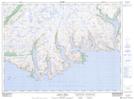
- Atlas of Canada Locator Map: Herring Net Brook
- GPS Coordinate Locator Map: Herring Net Brook Lat/Long
Herring Net Brook NTS Map Sheets