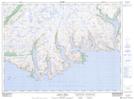
Maps showing Tilt Brook, Newfoundland and Labrador
Tilt Brook is a River located in Newfoundland and Labrador.
- Latitude: 47° 39' 13'' North (decimal: 47.6535898)
- Longitude: 56° 42' 46'' West (decimal: -56.7128798)
- Topography Feature Category: River
- Geographical Feature: Brook
- Canadian Province/Territory: Newfoundland and Labrador
- Atlas of Canada Locator Map: Tilt Brook
- GPS Coordinate Locator Map: Tilt Brook Lat/Long
Tilt Brook NTS Map Sheets