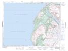
Maps showing Mad Molls, Newfoundland and Labrador
Mad Molls is a Shoal located in Newfoundland and Labrador.
- Latitude: 49° 17' 52'' North (decimal: 49.2977399)
- Longitude: 58° 16' 50'' West (decimal: -58.2805499)
- Topography Feature Category: Shoal
- Geographical Feature: Rocks
- Canadian Province/Territory: Newfoundland and Labrador
- Atlas of Canada Locator Map: Mad Molls
- GPS Coordinate Locator Map: Mad Molls Lat/Long
Mad Molls NTS Map Sheets