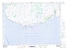
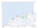
Maps showing Lee Beach Hill, Grand Bank, Newfoundland and Labrador
Lee Beach Hill is a Mountain located in Grand Bank, Newfoundland and Labrador and has an elevation of 83 meters.
- Latitude: 47° 0' 10'' North (decimal: 47.0027777)
- Longitude: 55° 56' 44'' West (decimal: -55.9455555)
- Topography Feature Category: Mountain
- Geographical Feature: Hill
- Canadian Province/Territory: Newfoundland and Labrador
- Elevation: 83 meters
- Location: Grand Bank
- Atlas of Canada Locator Map: Lee Beach Hill
- GPS Coordinate Locator Map: Lee Beach Hill Lat/Long
Lee Beach Hill NTS Map Sheets