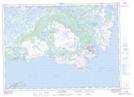
Maps showing Crow Head (French Point), Newfoundland and Labrador
Crow Head (French Point) is a Cape located in Newfoundland and Labrador.
- Latitude: 51° 22' 00'' North (decimal: 51.3666666)
- Longitude: 55° 29' 56'' West (decimal: -55.4988888)
- Topography Feature Category: Cape
- Geographical Feature: Head
- Canadian Province/Territory: Newfoundland and Labrador
- GPS Coordinate Locator Map: Crow Head (French Point) Lat/Long
Crow Head (French Point) NTS Map Sheets