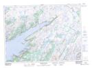
Maps showing Bay d'East Brook, Fortune-Hermitage, Newfoundland and Labrador
Bay d'East Brook is a River located in Fortune-Hermitage, Newfoundland and Labrador and has an elevation of 90 meters.
- Latitude: 47° 35' 39'' North (decimal: 47.5941666)
- Longitude: 54° 49' 42'' West (decimal: -54.8283333)
- Topography Feature Category: River
- Geographical Feature: Brook
- Canadian Province/Territory: Newfoundland and Labrador
- Elevation: 90 meters
- Location: Fortune-Hermitage
- Atlas of Canada Locator Map: Bay d'East Brook
- GPS Coordinate Locator Map: Bay d'East Brook Lat/Long
Bay d'East Brook NTS Map Sheets