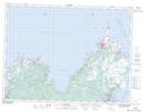
Maps showing Open Hall-Red Cliffe, Newfoundland and Labrador
Open Hall-Red Cliffe is a Unincorporated area located in Newfoundland and Labrador.
- Latitude: 48° 33' 14'' North (decimal: 48.5538888)
- Longitude: 53° 29' 29'' West (decimal: -53.4913888)
- Topography Feature Category: Unincorporated area
- Geographical Feature: Local Service District
- Canadian Province/Territory: Newfoundland and Labrador
- Atlas of Canada Locator Map: Open Hall-Red Cliffe
- GPS Coordinate Locator Map: Open Hall-Red Cliffe Lat/Long
Open Hall-Red Cliffe NTS Map Sheets