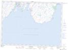
Maps showing Mistaken Point Ecological Reserve, St. Mary's - The Capes, Newfoundland and Labrador
Mistaken Point Ecological Reserve is a Conservation area located in St. Mary's - The Capes, Newfoundland and Labrador.
- Latitude: 46° 37' 55'' North (decimal: 46.6319444)
- Longitude: 53° 11' 25'' West (decimal: -53.1902777)
- Topography Feature Category: Conservation area
- Geographical Feature: Ecological Reserve
- Canadian Province/Territory: Newfoundland and Labrador
- Location: St. Mary's - The Capes
- Atlas of Canada Locator Map: Mistaken Point Ecological Reserve
- GPS Coordinate Locator Map: Mistaken Point Ecological Reserve Lat/Long
Mistaken Point Ecological Reserve NTS Map Sheets