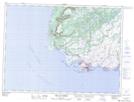
Maps showing Cheeseman Provincial Park, Burgeo and Lapoile, Newfoundland and Labrador
Cheeseman Provincial Park is a Conservation area located in Burgeo and Lapoile, Newfoundland and Labrador.
- Latitude: 47° 37' 46'' North (decimal: 47.629465)
- Longitude: 59° 15' 25'' West (decimal: -59.2568878)
- Topography Feature Category: Conservation area
- Geographical Feature: Provincial Park
- Canadian Province/Territory: Newfoundland and Labrador
- Location: Burgeo and Lapoile
- Atlas of Canada Locator Map: Cheeseman Provincial Park
- GPS Coordinate Locator Map: Cheeseman Provincial Park Lat/Long
Cheeseman Provincial Park NTS Map Sheets