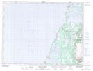
Maps showing Arches Provincial Park, St. Barbe, Newfoundland and Labrador
Arches Provincial Park is a Conservation area located in St. Barbe, Newfoundland and Labrador.
- Latitude: 50° 6' 49'' North (decimal: 50.1136111)
- Longitude: 57° 39' 47'' West (decimal: -57.6630555)
- Topography Feature Category: Conservation area
- Geographical Feature: Provincial Park
- Canadian Province/Territory: Newfoundland and Labrador
- Location: St. Barbe
- Atlas of Canada Locator Map: Arches Provincial Park
- GPS Coordinate Locator Map: Arches Provincial Park Lat/Long
Arches Provincial Park NTS Map Sheets