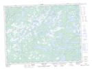
Maps showing Twenty-Eight Pond, Newfoundland and Labrador
Twenty-Eight Pond is a Lake located in Newfoundland and Labrador.
- Latitude: 49° 1' 36'' North (decimal: 49.0266666)
- Longitude: 54° 4' 17'' West (decimal: -54.0713888)
- Topography Feature Category: Lake
- Geographical Feature: Pond
- Canadian Province/Territory: Newfoundland and Labrador
- Atlas of Canada Locator Map: Twenty-Eight Pond
- GPS Coordinate Locator Map: Twenty-Eight Pond Lat/Long
Twenty-Eight Pond NTS Map Sheets