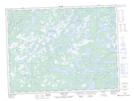
Maps showing Powder and Shot Pond, Newfoundland and Labrador
Powder and Shot Pond is a Lake located in Newfoundland and Labrador.
- Latitude: 49° 10' 43'' North (decimal: 49.1786111)
- Longitude: 54° 18' 42'' West (decimal: -54.3116666)
- Topography Feature Category: Lake
- Geographical Feature: Pond
- Canadian Province/Territory: Newfoundland and Labrador
- Atlas of Canada Locator Map: Powder and Shot Pond
- GPS Coordinate Locator Map: Powder and Shot Pond Lat/Long
Powder and Shot Pond NTS Map Sheets