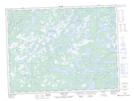
Maps showing Abel Tucks Bog, Newfoundland and Labrador
Abel Tucks Bog is a Low vegetation located in Newfoundland and Labrador.
- Latitude: 49° 14' 00'' North (decimal: 49.2333333)
- Longitude: 54° 16' 49'' West (decimal: -54.2802777)
- Topography Feature Category: Low vegetation
- Geographical Feature: Bog
- Canadian Province/Territory: Newfoundland and Labrador
- Atlas of Canada Locator Map: Abel Tucks Bog
- GPS Coordinate Locator Map: Abel Tucks Bog Lat/Long
Abel Tucks Bog NTS Map Sheets