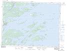
Maps showing Man Point Shore, Newfoundland and Labrador
Man Point Shore is a Beach located in Newfoundland and Labrador.
- Latitude: 48° 49' 25'' North (decimal: 48.8236111)
- Longitude: 53° 58' 23'' West (decimal: -53.9730555)
- Topography Feature Category: Beach
- Geographical Feature: Shore
- Canadian Province/Territory: Newfoundland and Labrador
- Atlas of Canada Locator Map: Man Point Shore
- GPS Coordinate Locator Map: Man Point Shore Lat/Long
Man Point Shore NTS Map Sheets