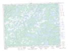
Maps showing Twelve Mile Pond, Newfoundland and Labrador
Twelve Mile Pond is a Lake located in Newfoundland and Labrador.
- Latitude: 49° 4' 59'' North (decimal: 49.0830555)
- Longitude: 54° 22' 28'' West (decimal: -54.3744444)
- Topography Feature Category: Lake
- Geographical Feature: Pond
- Canadian Province/Territory: Newfoundland and Labrador
- Atlas of Canada Locator Map: Twelve Mile Pond
- GPS Coordinate Locator Map: Twelve Mile Pond Lat/Long
Twelve Mile Pond NTS Map Sheets