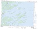
Maps showing Cottels Arm, Newfoundland and Labrador
Cottels Arm is a Bay located in Newfoundland and Labrador.
- Latitude: 48° 49' 17'' North (decimal: 48.8213888)
- Longitude: 53° 44' 48'' West (decimal: -53.7466666)
- Topography Feature Category: Bay
- Geographical Feature: Gulf
- Canadian Province/Territory: Newfoundland and Labrador
- Atlas of Canada Locator Map: Cottels Arm
- GPS Coordinate Locator Map: Cottels Arm Lat/Long
Cottels Arm NTS Map Sheets