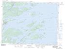
Maps showing Hare Bay Island, Newfoundland and Labrador
Hare Bay Island is a Island located in Newfoundland and Labrador.
- Latitude: 48° 51' 14'' North (decimal: 48.8538888)
- Longitude: 53° 58' 37'' West (decimal: -53.9769444)
- Topography Feature Category: Island
- Geographical Feature: Island
- Canadian Province/Territory: Newfoundland and Labrador
- Atlas of Canada Locator Map: Hare Bay Island
- GPS Coordinate Locator Map: Hare Bay Island Lat/Long
Hare Bay Island NTS Map Sheets