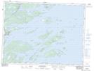
Maps showing Bloody Bay Reach, Newfoundland and Labrador
Bloody Bay Reach is a River feature located in Newfoundland and Labrador.
- Latitude: 48° 47' 5'' North (decimal: 48.7847222)
- Longitude: 53° 49' 55'' West (decimal: -53.8319444)
- Topography Feature Category: River feature
- Geographical Feature: Reach
- Canadian Province/Territory: Newfoundland and Labrador
- Atlas of Canada Locator Map: Bloody Bay Reach
- GPS Coordinate Locator Map: Bloody Bay Reach Lat/Long
Bloody Bay Reach NTS Map Sheets