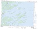
Maps showing Gander Cove, Newfoundland and Labrador
Gander Cove is a Bay located in Newfoundland and Labrador.
- Latitude: 48° 46' 53'' North (decimal: 48.7813888)
- Longitude: 53° 41' 46'' West (decimal: -53.6961111)
- Topography Feature Category: Bay
- Geographical Feature: Cove
- Canadian Province/Territory: Newfoundland and Labrador
- Atlas of Canada Locator Map: Gander Cove
- GPS Coordinate Locator Map: Gander Cove Lat/Long
Gander Cove NTS Map Sheets