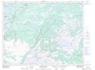
Maps showing Castor River South, Newfoundland and Labrador
Castor River South is a Unincorporated area located in Newfoundland and Labrador.
- Latitude: 50° 55' 17'' North (decimal: 50.9213888)
- Longitude: 56° 57' 1'' West (decimal: -56.9502777)
- Topography Feature Category: Unincorporated area
- Geographical Feature: Local Service District
- Canadian Province/Territory: Newfoundland and Labrador
- Atlas of Canada Locator Map: Castor River South
- GPS Coordinate Locator Map: Castor River South Lat/Long
Castor River South NTS Map Sheets