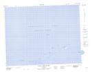
Maps showing Bill of Gunning Point, Newfoundland and Labrador
Bill of Gunning Point is a Cape located in Newfoundland and Labrador.
- Latitude: 49° 48' 42'' North (decimal: 49.8116999)
- Longitude: 54° 6' 52'' West (decimal: -54.1144000)
- Topography Feature Category: Cape
- Geographical Feature: Bill
- Canadian Province/Territory: Newfoundland and Labrador
- Atlas of Canada Locator Map: Bill of Gunning Point
- GPS Coordinate Locator Map: Bill of Gunning Point Lat/Long
Bill of Gunning Point NTS Map Sheets