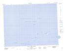
Maps showing Little Fogo Island, Newfoundland and Labrador
Little Fogo Island is a Island located in Newfoundland and Labrador.
- Latitude: 49° 48' 44'' North (decimal: 49.8121999)
- Longitude: 54° 7' 7'' West (decimal: -54.1186000)
- Topography Feature Category: Island
- Geographical Feature: Island
- Canadian Province/Territory: Newfoundland and Labrador
- Atlas of Canada Locator Map: Little Fogo Island
- GPS Coordinate Locator Map: Little Fogo Island Lat/Long
Little Fogo Island NTS Map Sheets