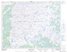
Maps showing Red Sea Pond, Newfoundland and Labrador
Red Sea Pond is a Lake located in Newfoundland and Labrador.
- Latitude: 50° 34' 43'' North (decimal: 50.5785999)
- Longitude: 56° 31' 12'' West (decimal: -56.5199999)
- Topography Feature Category: Lake
- Geographical Feature: Pond
- Canadian Province/Territory: Newfoundland and Labrador
- Atlas of Canada Locator Map: Red Sea Pond
- GPS Coordinate Locator Map: Red Sea Pond Lat/Long
Red Sea Pond NTS Map Sheets