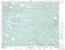
Maps showing Pond in the Hole, Newfoundland and Labrador
Pond in the Hole is a Lake located in Newfoundland and Labrador.
- Latitude: 50° 18' 19'' North (decimal: 50.3052999)
- Longitude: 56° 38' 7'' West (decimal: -56.6352999)
- Topography Feature Category: Lake
- Geographical Feature: Pond
- Canadian Province/Territory: Newfoundland and Labrador
- Atlas of Canada Locator Map: Pond in the Hole
- GPS Coordinate Locator Map: Pond in the Hole Lat/Long
Pond in the Hole NTS Map Sheets