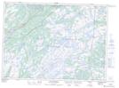
Maps showing Hardings Gullies, Newfoundland and Labrador
Hardings Gullies is a Lake located in Newfoundland and Labrador.
- Latitude: 47° 14' 55'' North (decimal: 47.2486000)
- Longitude: 53° 17' 24'' West (decimal: -53.2900000)
- Topography Feature Category: Lake
- Geographical Feature: Gullies
- Canadian Province/Territory: Newfoundland and Labrador
- Atlas of Canada Locator Map: Hardings Gullies
- GPS Coordinate Locator Map: Hardings Gullies Lat/Long
Hardings Gullies NTS Map Sheets